Blog
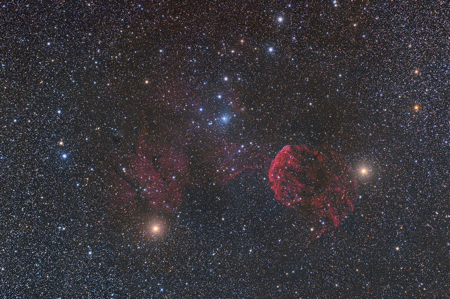
It’s a supernova remnant in the constellation Gemini. I did not know her before making the photo.
27 x 2 min
Camera : Nikon Z6 partially unfiltered
Telescope : Takahashi FSQ-106ED refractor.
Mount : Takahashi EM-200 homemade electronics.
Guiding : ZWO ASI290MM Mini on QHY OAG-M
Temperature : 3 to 1°C
Humidity : 85% to 100%
SQM : 21.2
Software : auto-guiding with PHD2, acquisition with Astro Photography Tool, processing with PixInsight.
Location : L’Epine
Ordesa and Mont-Perdu National Park, Spanish Pyrenees
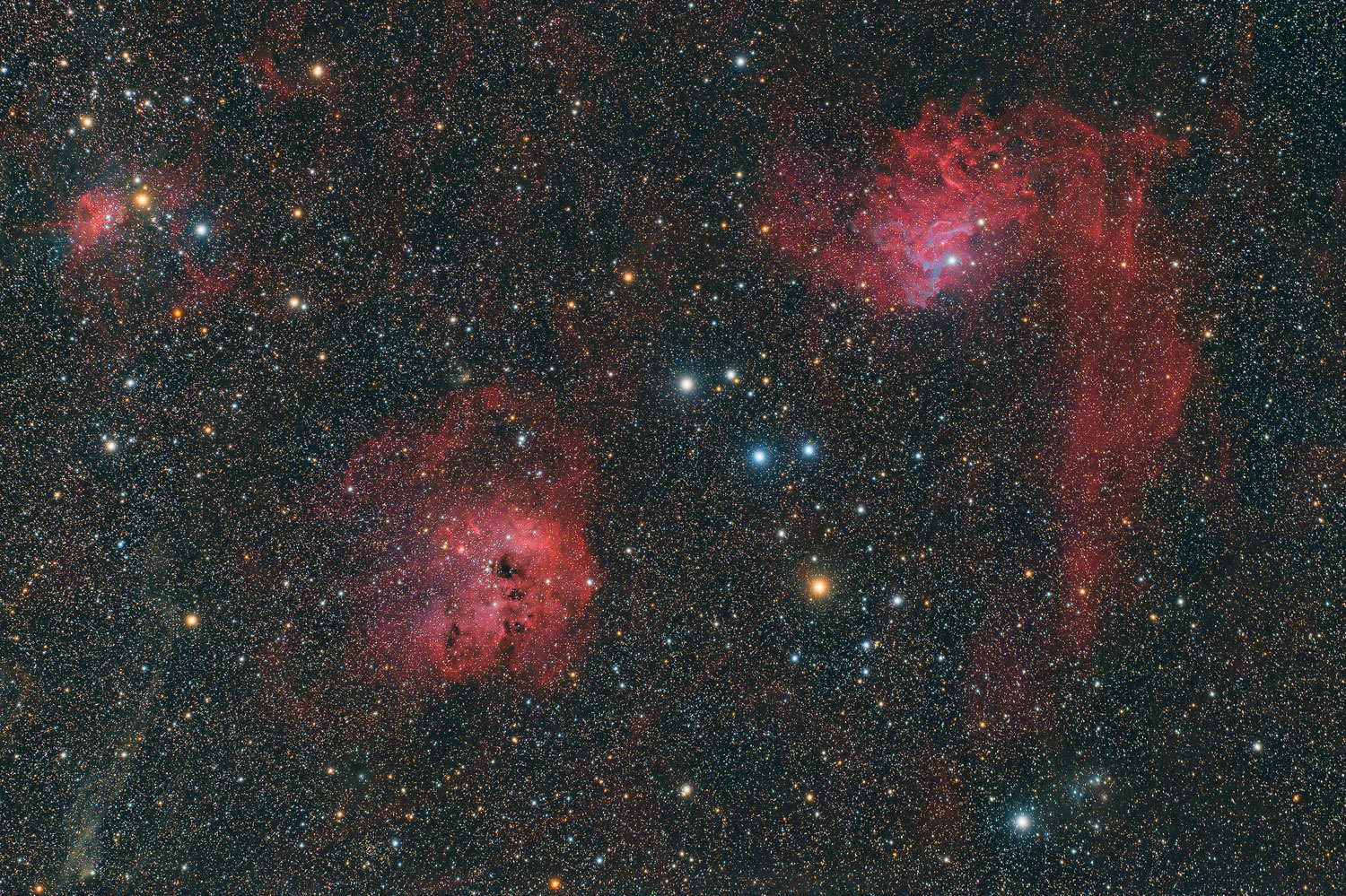
From left to right, or from smallest to largest:
– IC 417, the small Spider Nebula
– IC 410, the Tadpoles
– IC 405, the Flaming Star Nebula
Shot on December 31, 2021, about an hour before we change the year. And that’s the only deep sky image of the year, a crappy weather year.
65 x 1 min
Camera : Nikon Z6 partially unfiltered
Telescope : Takahashi FSQ-106ED refractor.
Mount : Takahashi EM-200 homemade electronics.
Temperature : 7°C
Humidity : 65%
SQM : 21.0
Software : acquisition with Astro Photography Tool, processing with PixInsight.
Location : Le Plan, Col du Banchet
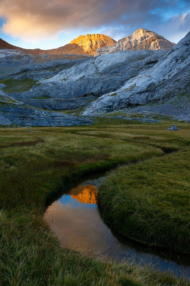
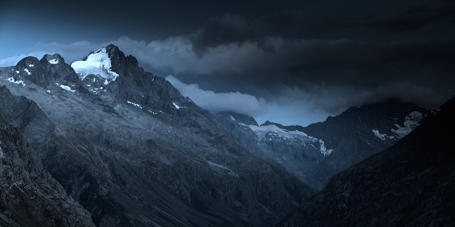
The cloud ceiling settled over the Grenoble area at the end of the morning and is not willing to move. According to the webcams, it is located around 2000-2100m altitude. So above the Vercors. We won’t be able to enjoy the fog in the forest or the sea of clouds. As for the Oisans, it is rather the opposite. The morning clouds dissipate announcing a storm of blue sky.
I decide to go to Oisans. The goal is always to have a good time in the mountains, photography is secondary.
Clouds begin to form in the late afternoon. The golden hour is coming, the hour before sunset. But the light remains harsh with strong contrasts. The Sun passes through high altitude clouds before setting, there will be no beautiful colors. Too bad, it won’t be for this time. It is still so good to be here, in this beautiful place, discovering a new view on this summit that I know so well.
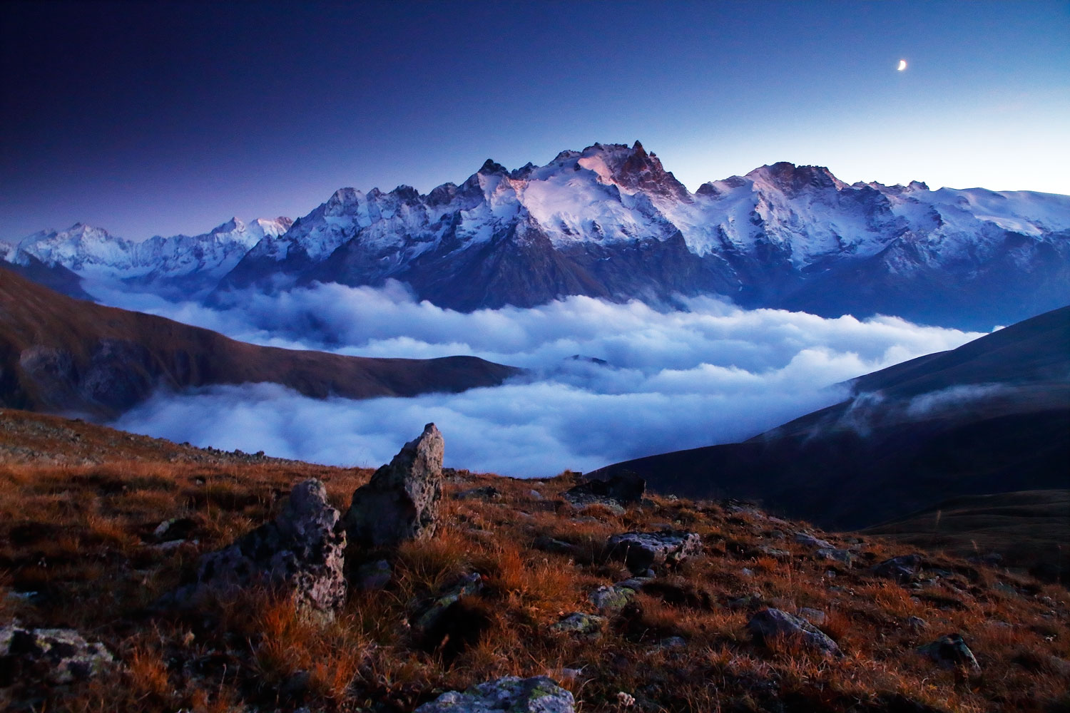
Oh wait! After the sunset there is the blue hour, maybe something will happen again. The clouds are well up, it’s a real tide now. There are still glimmers of light in the mountains and the moon is starting to come down into the frame. Finally, everything lines up…
Well, except that it’s late, the exposure times are getting a little too long and I don’t have the right tripod. And then I have to go back down the steep grassy slope with the headlamp and almost through the fog! Everything went well. It was Sunday evening.
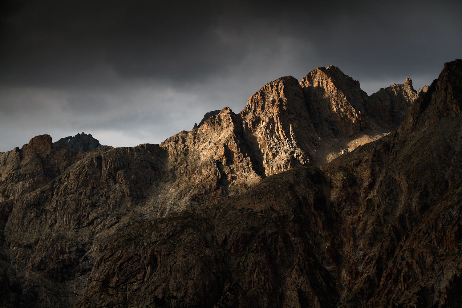
After a long ascent which will end in a nasty scree, I walk quietly on this ridge. The grassy slopes have given way to a lunar terrain. The scenery all around is grandiose. There is no path here. To get there, you have to know the area. And it gives the feeling of being privileged, I imagine that few people pass by here.
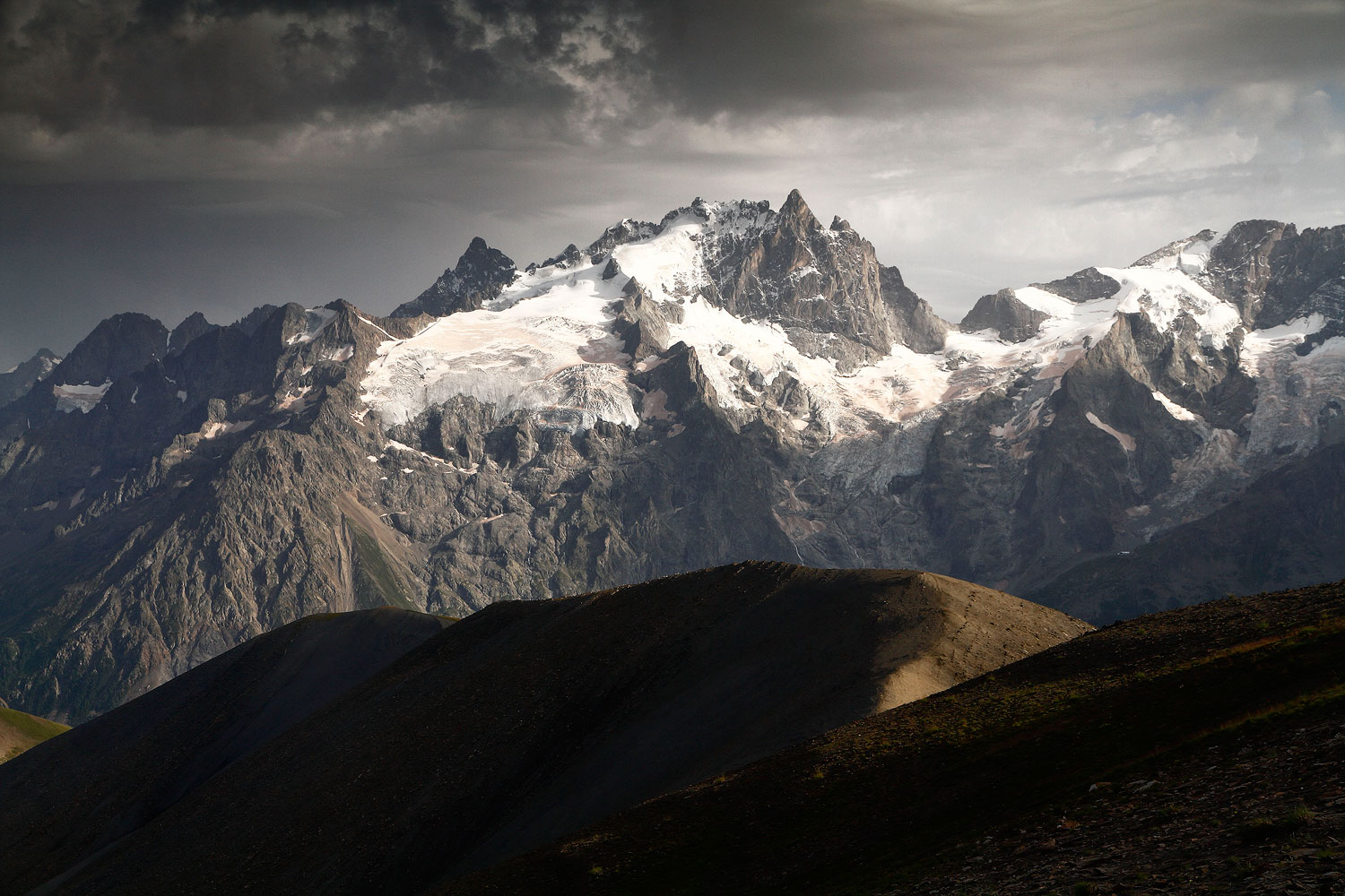
I am in the sun. Clouds are coming in from the west. They seem to have decided to blend together over the Ecrins to form a very dark ceiling. The Meije keeps its white dress in the light.
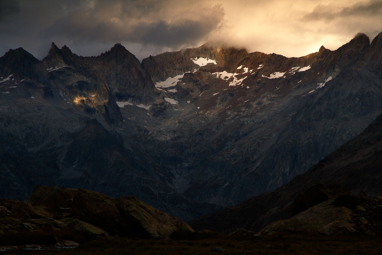
The clouds pass and spread their shadows. They are set ablaze with the peaks in the light of a late afternoon.
Massif du Soreiller. Ecrins National Park. August 2020.
Last September, last week before the weather got fickle.
The girl next door,
The neighbor,
Great is beautiful.
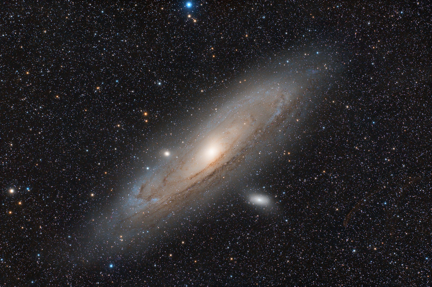
Well especially in photos because, visually, it is rather a big blurry spot. I call it a big cosmic scam for newbies. The Andromeda Galaxy is the large galaxy located right next to ours just 2.5 million light years away. It is the most famous. It is the most distant object that you can see with the naked eye. So inevitably, the beginner in astronomy will quickly point his brand new telescope on it to see … a blurred spot! And then you’ll see him appear on the forums to ask if he’s pointed at the right place or if his telescope is out of order. No no, everything is normal, there’s just nothing more to see! In fact, it is better to observe him with a simple pair of binoculars.
For this photo the acquisitions were made on the night of Saturday October 17 to Sunday 18 under rather specific conditions. 0 ° C and 100% humidity. I was wondering if it’s that wet when it rains! Everything was soaked. I wiped the PC screen with kleenex. On the refractor I have a heating element to prevent due which did the job very well, to my astonishment. The Nikon Z6 refuses to recognize the fake battery that allows me to power it with a large 4S li-ion. Forcing to put the real battery on it, which necessarily limited the autonomy. At 4 a.m. it was covered with a good layer of frost. And finally, there is a flare. So I will have to redo it. Probably in 4 or 5 years, time to bring together the right conditions at the right time.
49 x 1 min
Camera : Nikon Z6 partially unfiltered
Telescope : Takahashi FSQ-106ED refractor.
Mount : Takahashi EM-200 homemade electronics.
Guiding : ZWO ASI290MM Mini on QHY OAG-M
Temperature : 0°C
Humidity : 100%
SQM : 21.55
Software : auto-guiding with PHD2, acquisition with Astro Photography Tool, processing with PixInsight.
Location : L’Epine
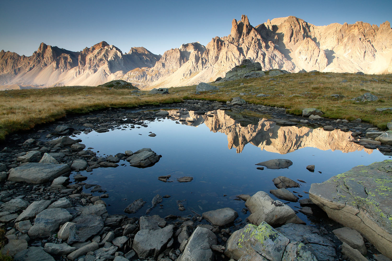
The blue hour in the Ecrins. Everything is very quiet. Only the murmur of the torrents coming down from the valleys below breaks the silence.